
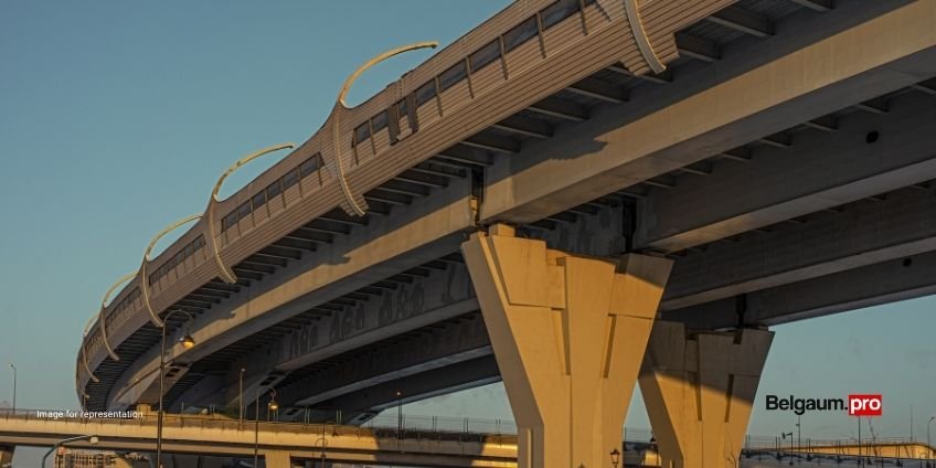
Belagavi’s first-ever flyover project, aimed at easing growing traffic congestion, has entered a more advanced preparatory stage. In a key development on the ground, trees along the stretch between Samrat Ashok Chowk and Kittur Rani Chennamma Circle near Fort Lake have been numbered and mapped.
The exercise was jointly conducted by the Public Works Department (PWD) and the Forest Department on Monday (16). This step is essential ahead of land acquisition and road widening, indicating that the project is moving steadily from planning towards execution.
The proposed flyover, the first in the city, will span about 4.5 km and is designed to decongest some of Belagavi’s busiest junctions. It will begin from National Highway-48 near Sankam Hotel in Gandhinagar, pass through Ashoka Circle and Sangolli Rayanna (RTO) Circle, extend to Kittur Rani Chennamma Circle, and terminate at Chhatrapati Dharmaveer Sambhaji Chowk. From there, it will continue along Dr. Ambedkar Road past KLE Hospital before reconnecting to the highway near ICMR.
The alignment covers key internal stretches such as Samrat Ashok Chowk and Chhatrapati Dharmaveer Sambhaji Chowk, which currently face heavy traffic congestion.
Key Structural Details
According to the project outline, the scale and engineering requirements are significant:
- A 6,678-metre elevated section will be constructed by the PWD, supported by 167 pillars.
- Another 1,112-metre stretch will be executed by the National Highways Authority of India (NHAI), with 22 pillars.
Together, these will form a major elevated corridor aimed at improving traffic flow across multiple junctions.
The flyover will include several spans with a large number of pillars, with different segments handled by the PWD and NHAI. Rotaries are planned at major junctions like Ashoka Circle and Chennamma Circle to facilitate smoother movement below. Multiple entry and exit ramps will connect key points such as the Central Bus Stand, RTO, Mahantesh Nagar, and Kolhapur Circle. A dedicated service road along with a Road Over Bridge (ROB) is also proposed to enhance connectivity towards Sambra Airport.
The design has already received in-principle approval from the district administration, and the alignment map has been released, marking another milestone.
If approvals and tendering proceed on schedule, construction is likely to begin within the next 6–12 months. Considering the scale of the project, completion is expected to take around 3 to 4 years.
While earlier estimates suggested a two-year timeline after work begins, experts believe a more realistic duration would be closer to three years, taking into account land acquisition, utility shifting, and phased execution in dense urban areas.


